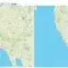
MAPfrappe
MAPfrappe is a prominent site for cartographic mixtures that enables you to compare Geographic Sizes for different sites in the world like countries, cities, buildings, provinces, and parks. It is easy to use, and you merely have to draw an outline in the top map, after which it will be shown in the correct size at the bottom map. As an example, you can think of sketching an outline of the state of California in the US in the “Reference Map,” and once this is done, you can proceed to overlay the outline over any other country in the World like Italy in the “Comparison Map”. The web app requires all users to have a basic education of Google map interactions for a better experience.
MAPfrappe Alternatives
#1 Comparea
Comparea is an online solution that gives you the ability to compare the area of two different geographic locations with great ease. The UI consists of two maps in a vertical structure with an informative box on the right side of the screen, describing the details about the geographic locations being compared. You can begin the experience by selecting c country on both of the boxes, after which the results will be shown. The best feature is that the web app consists of many famous locations in the world, giving you the opportunity to run comparisons on them and view the information regarding them.
#2 MapMartini
MapMartini is a handy online tool that gives you the opportunity to compare the sizes of geographic areas. It requires individuals to have basic knowledge about Google maps for a better journey. You can begin the experience by sketching a polygon map and then overlaying it onto a different section of the world. The best and most prominent feature of the map is that it allows everyone to rotate the shape and draw paths on the target map. Once the individual draws the polygon on the left map, a polygon of the same size will be shown on the right side. You can zoom in and out of the map through the given controls and search for a location via the search icon.
#3 GeoReferencer
GeoReferencer is a web app that makes it easy for you to assign a geographical location to the uploaded image. You will find it really easy to use as it only asks you to drag an image file or browse one from the computer. Once the image has been uploaded, you can find similar points and add coordinates. The third step is previewing the image and interacting with it in various ways like overlaying, comparing, and annotating.
The final stage consists of downloading GeoTiff, and utilizing desktop GIS through WMTS or embedding online. The online solution caters to the needs of Businesses, Private users, and Institutions. Private users can convert any image into map overlay, compare, export, get accurate geolocations, and access advanced features. Businesses can leverage authenticated access, perform private batch exports, retrieve analytics for workers, and initiate quality assurance.
#4 PetersMap
PetersMap is a top-notch map projection that shows countries in accurate proportion next to each other. It is used by businesses, schools, the UN, and aid agencies worldwide. It functions as an equal area cylindrical projection having 45 degrees of standard parallels, leading to the output of shape distortion, which is flexed about the equator and taken to the poles. The benefit is that each and every country is of the right size and is associated with each other. It is prominently used in business and academic areas as the standard for equality in the world.
#5 The True Size
The True Size is a powerful and highly useful online map app that enables you to calculate the physical size of regions across the globe. Representing the spherical world on flat paper is a difficult task in itself and requires a considerable amount of effort. A technique called “Projection” is utilized by Cartographers to morph the globe into a 2D map. One of the prominent among these methods is known as the Mercator projection.
Each map production demonstrates distortion and has problems unique to it. The complaints directed towards the Mercator map is that it expands the size of countries next to the poles by a huge margin while not taking into account the size of those lying next to the equator. Greenland shows the exact same miles as Africa on the Mercator projection. But this is not how it is in reality, as the difference between Greenland and Africa is 0.8 million sq. miles and 11.6 million sq. miles, respectively.
#6 ByMap
ByMap is an online, simple, and easy-to-use tool that allows you to compare two locations on planet earth. It has a user-friendly interface consisting of two maps side by side to help you view the differences and get the information regarding them. There are no restrictions whatsoever, and the audience can run as many comparisons as they deem necessary. The objective of the site is to give everyone the ability to calculate the size and other parameters of two distinct locations with great ease. Lastly, it covers most of the locations in the world, enabling you to rely on it for all your comparisons.
#7 OverLapMaps
OverLapMaps lets you perform a comparison on two distinct geographical locations in the world. It is basically a map of a single part of the world that overlaps a different section of the world. You can use it to view the relative size of the locations. The individual can begin comparing maps by selecting from the two menus. Both of these menu boxes contain the name of countries that you can overlap. The first box consists of the geographic location that you can overlap, while the second map includes locations that the first one can be overlapped on.


